The Belgian territory during the German occupation of 1914-1918


etgeb.jpg
  piren.jpg
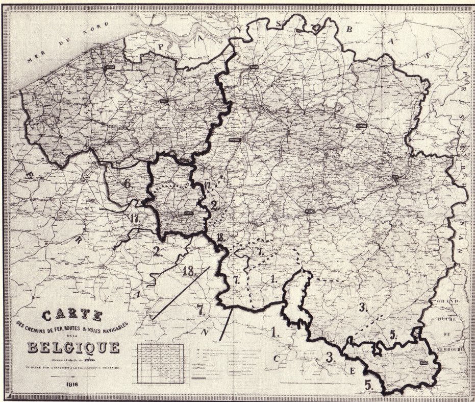
Map Grenzen van het "Gouvernement-Generaal" en van het "Etappegebied".
scanned from: vol. iv, p. 318 of: Henri Pirenne, Geschiedenis van België, Brussel, La Renaissance du Livre, s.d. (+- 1950?)

The territory of Belgium in the war years 1914-1918


The occupation timeline


The unoccupied part of Belgium in the West of Flanders (Westhoek)


flan.jpg
front.jpg
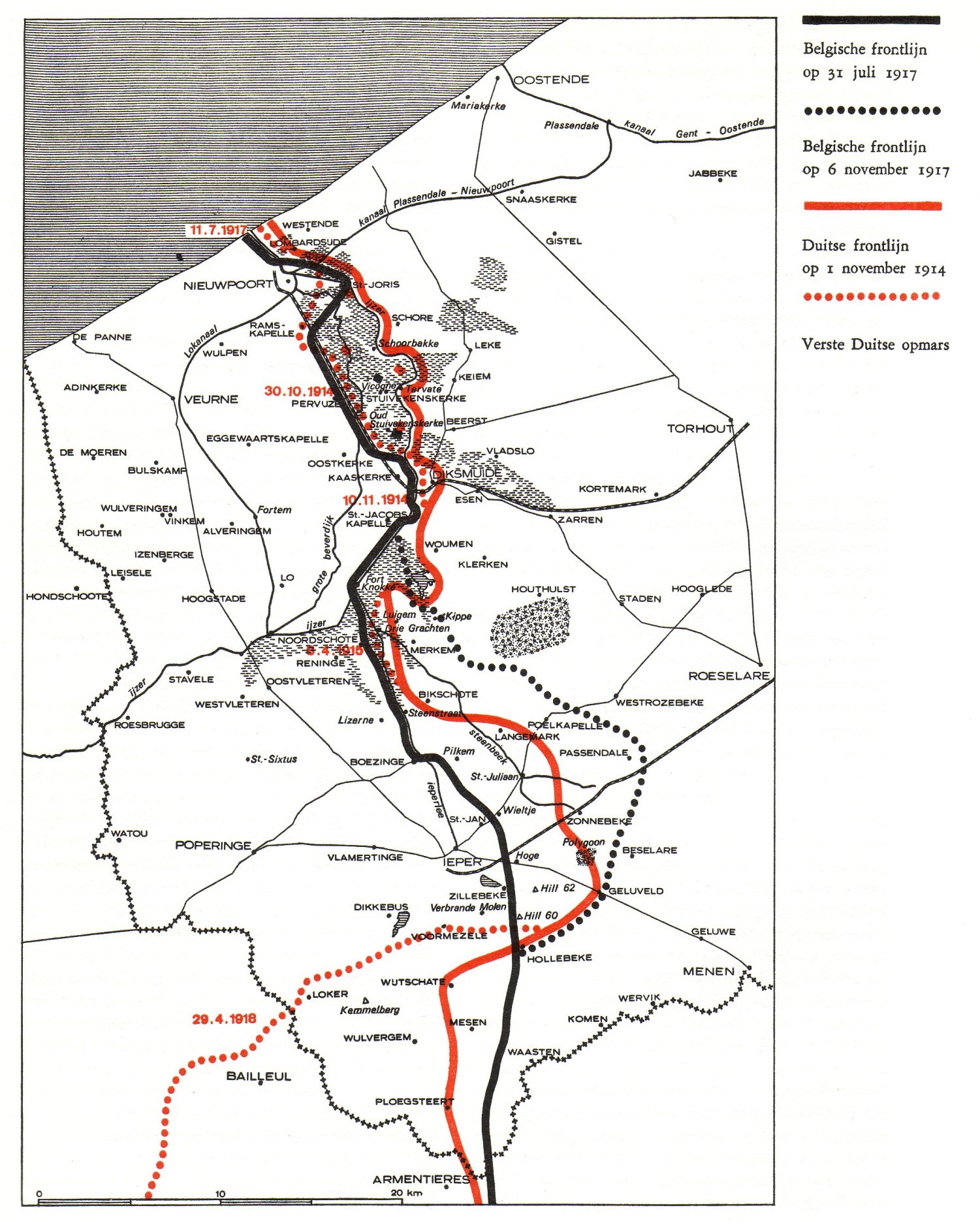
Map scanned from:  p. 18 in: Luc Devliegher & Luc Schepens, Front 14/18, 1968, Tielt & Den Haag, Lannoo


The electrical fence at the Belgian Dutch borderline

For avoiding uncontrolled Belgian-Dutch contacts, the Germans installed a supervised electrical fence at the Belgian-Dutch border, between the North See and the German town of Aachen, all along the borderline.. The construction, conceived by D. Schütte, a German army officer, was finished in August 1915. About 500 Belgians lost their lives in the fence.
Some Belgian borderline villages, including the enclaves of Baarle-Hertog, were left at the Dutch side of the fence.

elec2.jpg

elec.jpg
   dexia.jpg
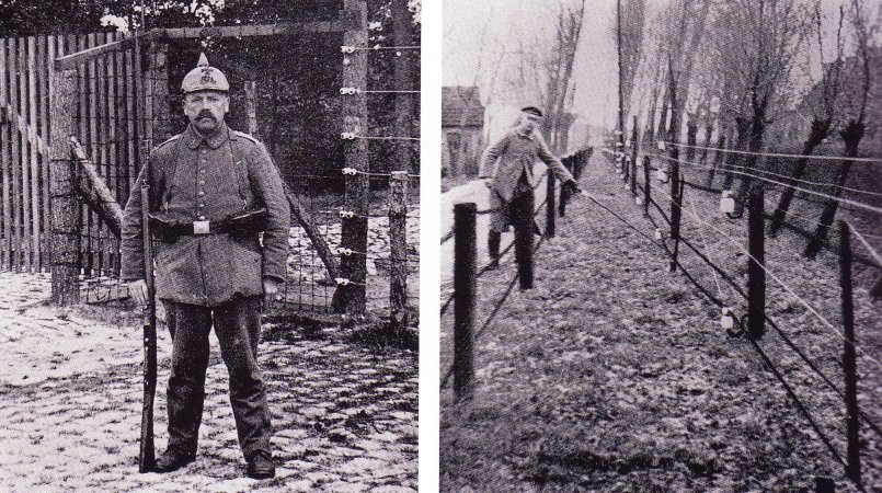
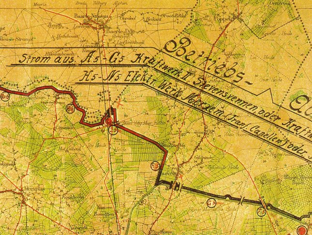
scanned from pp. 62 (picture) and 52 (map) in:
Alex Vanneste, "Het eerste "IJzeren gordijn? De elektrische draadversperring aan de Belgisch-Nederlandse grens tijdens de Eerste Wereldoorlog.",
pp. 39-82 in "Tijdschrift van de Dexia Bank", vol. 54, nr. 214, 2000/4


This page is created as illustration for our pages about the history of the territory of Belgium
Created 2003-08-08, relocated to the Combell server on 2020-10-25
Some texts may be affected by copyrights and eventually need to be removed from this server in the future
© Roger Thijs, Euro-Support, Inc.